

Desktop GIS data quality for electricity networks
Network GIS data you can trust
GIS GridAtlas audits every delivery, merges editions without duplicates, checks topology and electrical rules, and documents the result to ISO 19115. On Windows, offline, with or without ArcGIS Pro.
- USD 8,223 + VAT, one licence
- Every module included
- Works fully offline
- Shapefile
- File geodatabase
- GeoPackage
- ArcGIS Pro
- ISO 19115 / 19139
- Excel and Word reports
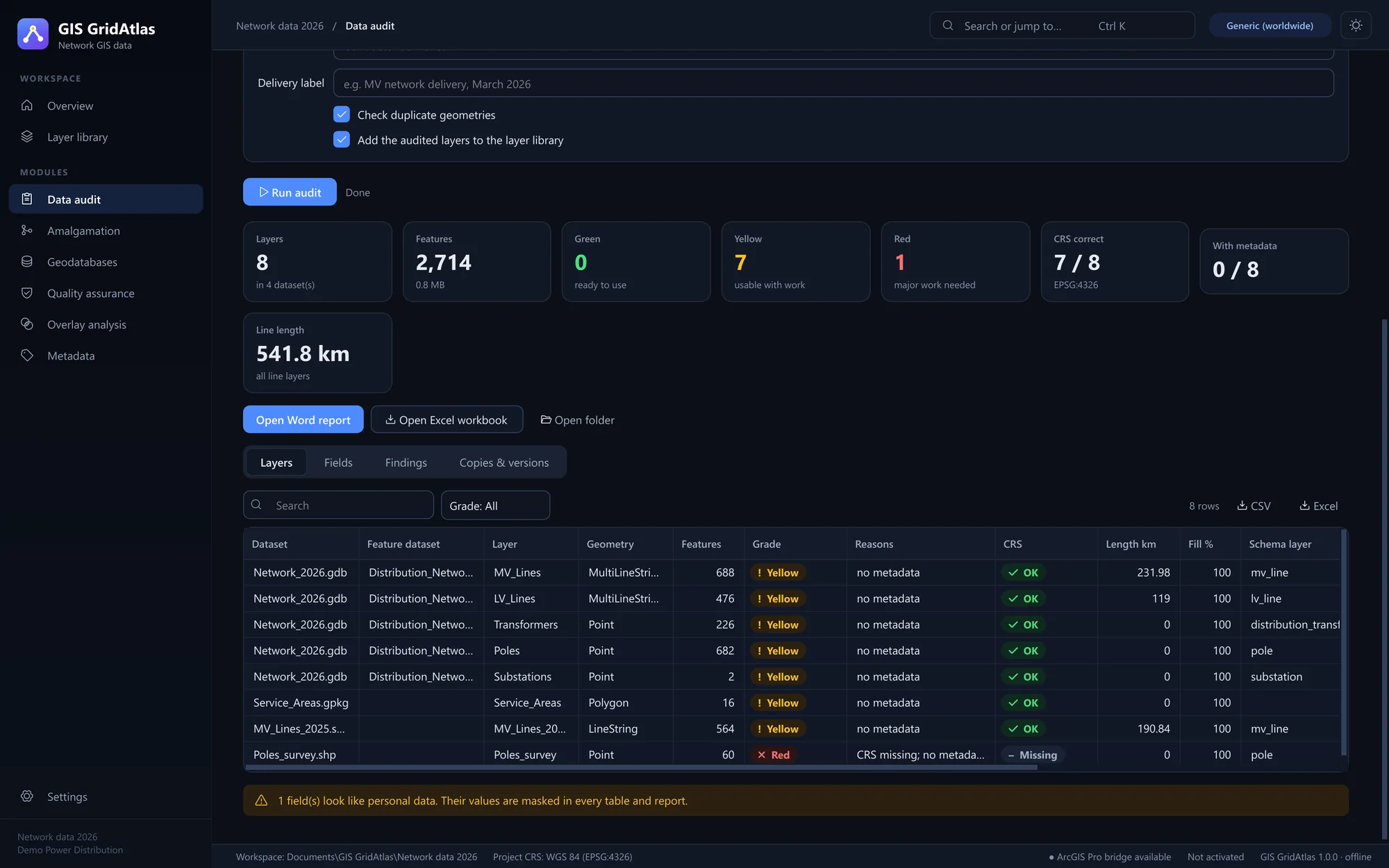
Measured on a national distribution network
Timed on an ordinary Windows laptop, with the same build you download. No server, no cloud and no sampling: every feature, every rule.
- Features audited
- 12.5million
628 layers and 21 GB of deliveries graded in about ten minutes.
- MV spans amalgamated
- 570thousand
Two editions merged in under three minutes, re-digitised spans matched instead of doubled.
- Poles topology-checked
- 576thousand
Disjoint and on-the-line rules across a national LV network in under 30 seconds.
- Data sent over the internet
- 0bytes
Everything runs on the computer the data was delivered to. Source files are only ever read.
Six modules, one workflow from delivery to dataset
Each step writes a report you can hand over and records what it did, so the metadata's processing history writes itself.
Results you can hand over, not just look at
Every run ends in files a manager, a contractor or an auditor can open without GIS GridAtlas. Each one records what was checked, against which rules, and when.
-
Word report
Findings in plain language, layer by layer, ready for a project file or a contractor.
-
Excel workbook
Every layer, field and error in sortable sheets, with personal data masked.
-
Error GeoPackage
Each topology error as a located feature, to fix in ArcGIS Pro or QGIS.
-
ISO 19115 metadata
Extent, coordinate system, quality and lineage, in the format ArcGIS imports.
-
File geodatabase
Merged, checked layers in feature datasets, in one coordinate system.
Made for the teams that keep the network map
Utilities
Bring contractor as-builts and district updates into one network model.
Regulators and ministries
Grade every submission the same way and return a report that shows what to fix.
Electrification agencies
Combine project deliveries and link them to villages and districts for planning.
GIS consultancies
Deliver audited, documented datasets with a lineage your client can check.
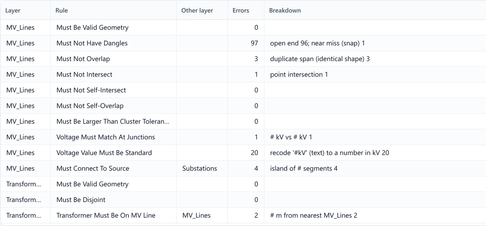
Topology rules that understand a power network
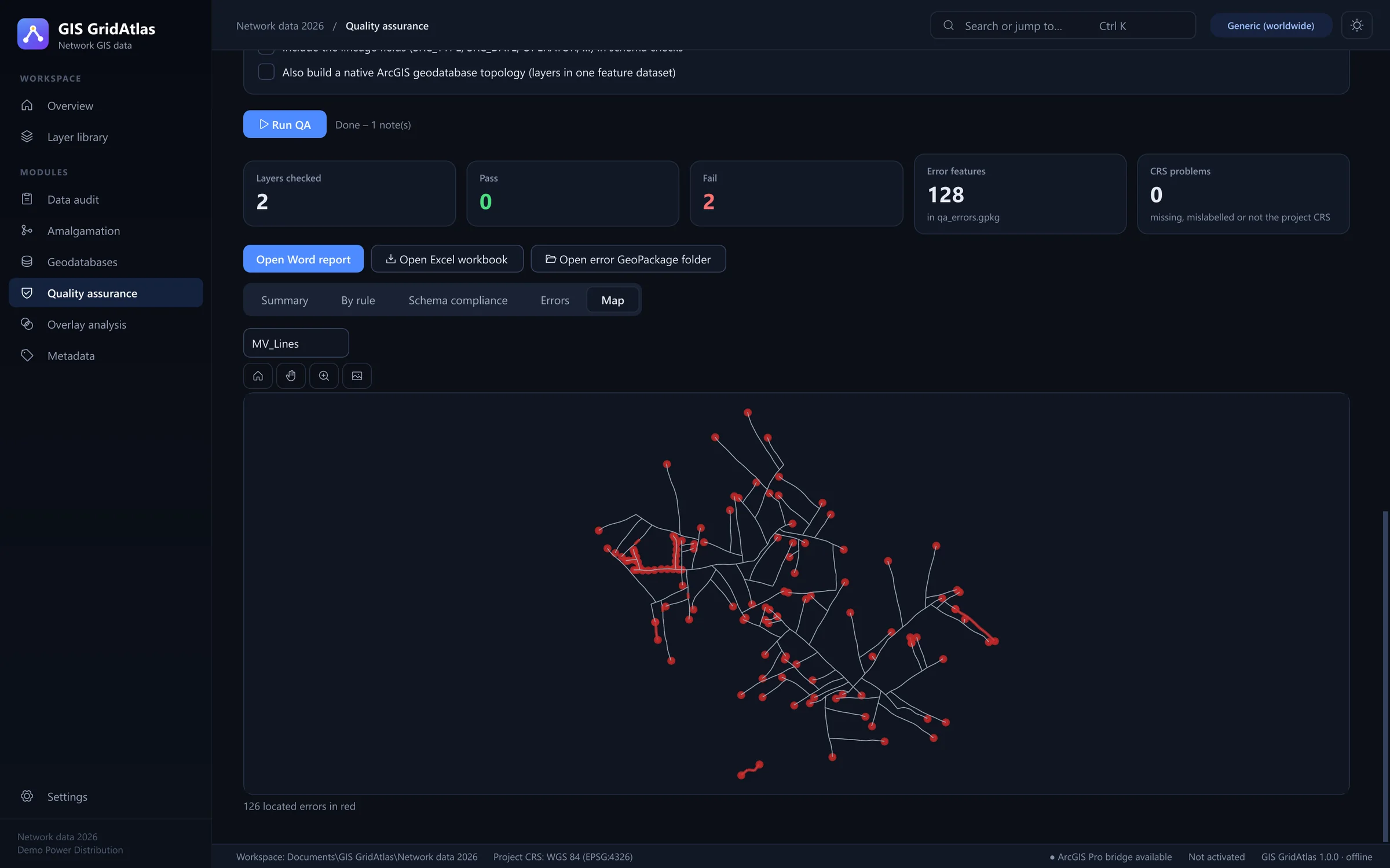
Generic GIS checks call a double circuit an overlap and every pole a pseudo node. GIS GridAtlas reads the network the way an engineer does.
- Islands that reach no source, with the feeder their spans claim
- Transformers off the MV line, beyond the distance you set
- Voltage clashes where no substation can transform
- Dangles split in two: near misses to snap, open ends to survey
- Voltage codes read correctly: 33.33 is a double circuit, 11000 is in volts
Gives the same dangle and overlap counts as ArcGIS Pro's native geodatabase topology.
Built for confidential infrastructure data
Network maps are critical-infrastructure records. GIS GridAtlas has been tested comprehensively on real deliveries from utilities, ministries and agencies in different regions, and handles them accordingly.
- Nothing leaves the computer
- GIS GridAtlas runs entirely on your Windows machine. No upload, no cloud account and no internet connection, so a national network never travels further than the desk it was delivered to.
- Delivered files stay untouched
- Shapefiles and geodatabases are only ever read. Every result is written to a new layer or file, and GIS GridAtlas asks before it replaces anything that already exists.
- Personal data stays masked
- Customer names, phone numbers and ID numbers are detected in attribute tables, including truncated shapefile field names, and masked in every table, report and log.

For IT and procurement
- Runs on
- 64-bit Windows 10 or 11. 16 GB of memory recommended for national networks.
- Internet
- Only to activate, once. Computers with no internet activate from any phone.
- Licence
- Perpetual, for up to three computers in your organisation, with a year of updates.
- ArcGIS Pro
- Optional. Used, when present, for native topology and metadata import.
- Formats
- Shapefile, file geodatabase and GeoPackage in; the same plus Word, Excel and ISO XML out.
- Payment
- Online by card through Pesapal, with a VAT receipt by email.
A tool you own, not a platform you rent
Enterprise utility GIS platforms run whole networks and are worth it at that scale. For getting deliveries clean before they reach one, there is a lighter way.
| Question | GIS GridAtlas | Enterprise utility GIS platform | Checking by hand in desktop GIS |
|---|---|---|---|
| What it costs | USD 8,223 once, every module | Annual subscription, quoted per user | Staff days on every delivery |
| Time to first result | The day you install it | After an implementation project | Days to weeks per delivery |
| Power-network rules | Built in: islands, voltage clashes, transformers off the line | Configured by specialists | Written and rerun by hand |
| A report to hand over | Word, Excel and error layers, every run | Depends on configuration | Assembled by hand |
| Where the data goes | Nowhere: it stays on your computer | Often a hosted or central server | Stays on your computer |
One price. Every module. Yours to keep.
No subscription, no per-user fees and no edition to outgrow. Pay once by card and the licence key arrives by email.
USD 8,223+ VAT, one-time
- All six modules
- Up to 3 computers
- A year of updates
- Email support
Questions
Anything else: support@gisgridatlas.com
Do I need ArcGIS Pro?
No. GIS GridAtlas reads and writes file geodatabases, including feature datasets and metadata, on its own. With ArcGIS Pro installed it can also build a native geodatabase topology and import metadata straight into it.
Does it work in my country and coordinate system?
Yes. Set a required coordinate system for a project, or leave it open: lengths and areas are then measured in metres in the data's local UTM zone, so results are correct anywhere.
How do I receive the software?
As soon as Pesapal confirms the payment, we email your licence key, your receipt with the VAT breakdown and a private download link for the Windows installer.
What computer does it need?
A 64-bit Windows 10 or 11 PC. For national networks with hundreds of thousands of spans, 16 GB of memory is recommended.
How do we pay?
Online, here on the site: by card through Pesapal at checkout. The licence key, the receipt and the download link arrive by email as soon as the payment is confirmed.